|
Home
Catalogue
Information
Copyright
Other Stock Image websites

Latest additions -
Athens, ancient ruins, c1775
Pulo Penang, Malaysia, c1840
The Capitol, Washington, 1840
Middlesex county map, 1786
Philadelphia plan (SDUK), 1844
Lancashire county map, 1807
Ireland map, 1773
Austria-Hungary map, 1887
Notre Dame, Paris, 1840
Essex map, 1809
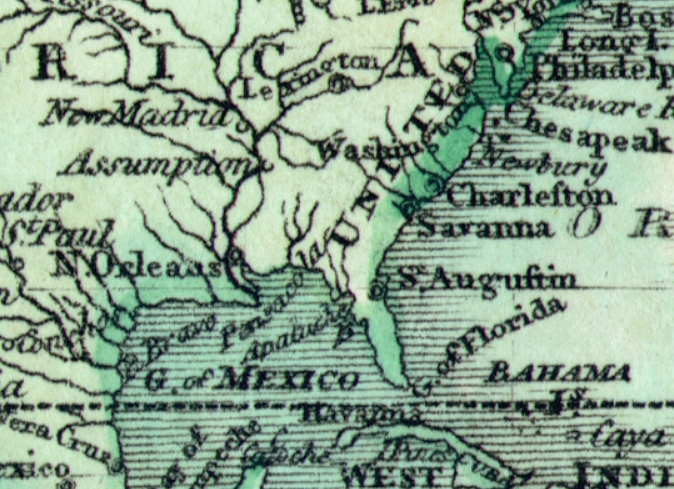
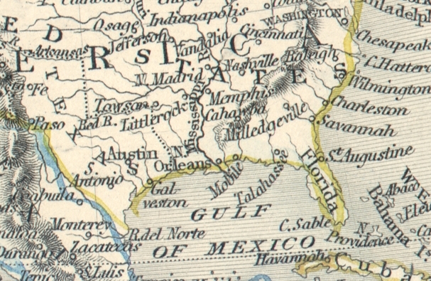
Eastern USA map, 1852
Calcutta view, 1850
Bohemia map, 1773
Dardanelles view, Turkey, 1828
Baltic Sea Tallis map, 1860
Plan of medieval Paris, 1884
Istanbul view, 1770
|
World Maps - historical antique map image downloads
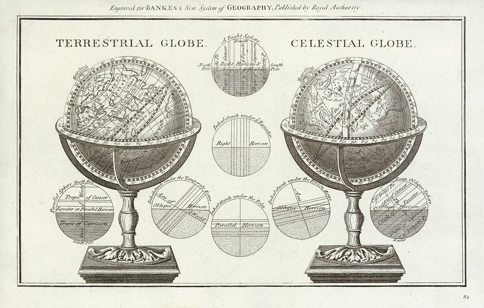
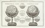 "Terrestrial Globe" and "Celestial Globe" drawn and engraved for Bankes's New System of Geography, published about 1787. The original is a copper engraved print. Click the small image to the left for a larger low resolution version. (Ref sm0170). Digital image
10.8mb at 400dpi. "Terrestrial Globe" and "Celestial Globe" drawn and engraved for Bankes's New System of Geography, published about 1787. The original is a copper engraved print. Click the small image to the left for a larger low resolution version. (Ref sm0170). Digital image
10.8mb at 400dpi.
Price 5 USD, Click here to buy
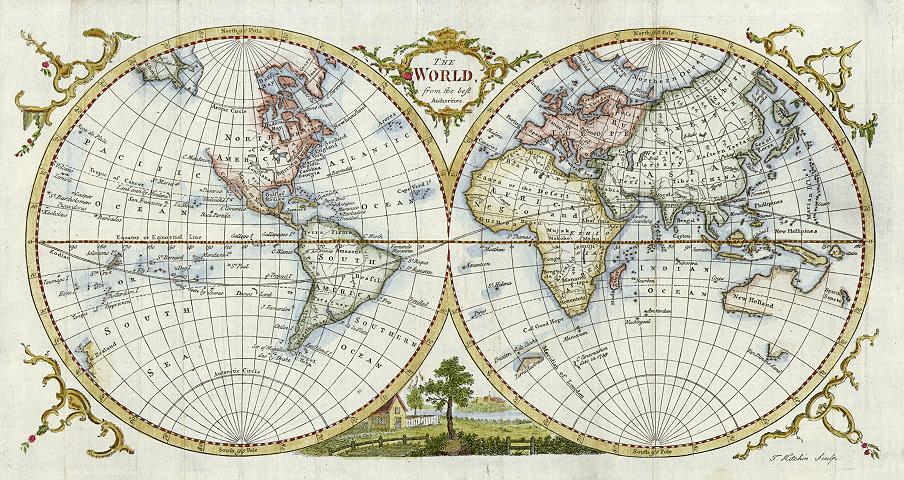
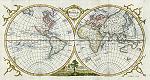 "
The World From the Best Authorities " engraved by Thomas Kitchin, published in
Guthrie's New Geographical Grammar, 1777. The original is a copper engraved map
and the hand colouring is recent. Click here for detail showing part
of the map at full resolution (600 dpi). Click the small image
to the left for a larger low resolution version. (Ref sm0004). Digital image
27mb at 600dpi. "
The World From the Best Authorities " engraved by Thomas Kitchin, published in
Guthrie's New Geographical Grammar, 1777. The original is a copper engraved map
and the hand colouring is recent. Click here for detail showing part
of the map at full resolution (600 dpi). Click the small image
to the left for a larger low resolution version. (Ref sm0004). Digital image
27mb at 600dpi.
Price 5 USD, Click here to buy
_tn.jpg) "
A Map of the World from the Best Authorities " engraved by Barlow, published in
a General View of the World, London, 1816. The original is a copper engraved map
and the hand colouring is original. Click
here for detail showing part
of the map at full resolution (400 dpi). Click the small image
to the left for a larger low resolution version. (Ref sm0012). Digital image
23mb at 400dpi. "
A Map of the World from the Best Authorities " engraved by Barlow, published in
a General View of the World, London, 1816. The original is a copper engraved map
and the hand colouring is original. Click
here for detail showing part
of the map at full resolution (400 dpi). Click the small image
to the left for a larger low resolution version. (Ref sm0012). Digital image
23mb at 400dpi.
Price 5 USD, Click here to buy
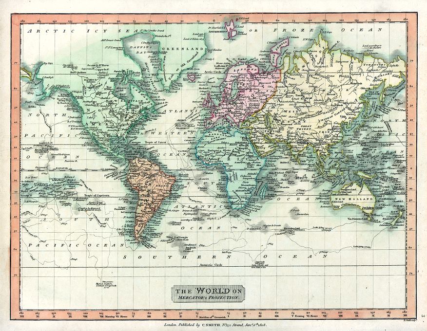
 "The World on Mercator's Projection" engraved by R.Smith, published by C.Smith in Smith's New General Atlas, London, 1808. The original is a copper engraved map
measuring 35.5 x 27 cms, with full original hand colour. Click
here for detail showing part
of the map at full resolution (500 dpi). Click the small image
to the left for a larger low resolution version. (Ref sm0191). Digital
image size 30.4 mb at 500 dpi. "The World on Mercator's Projection" engraved by R.Smith, published by C.Smith in Smith's New General Atlas, London, 1808. The original is a copper engraved map
measuring 35.5 x 27 cms, with full original hand colour. Click
here for detail showing part
of the map at full resolution (500 dpi). Click the small image
to the left for a larger low resolution version. (Ref sm0191). Digital
image size 30.4 mb at 500 dpi.
Price 5
USD, Click here to buy
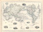
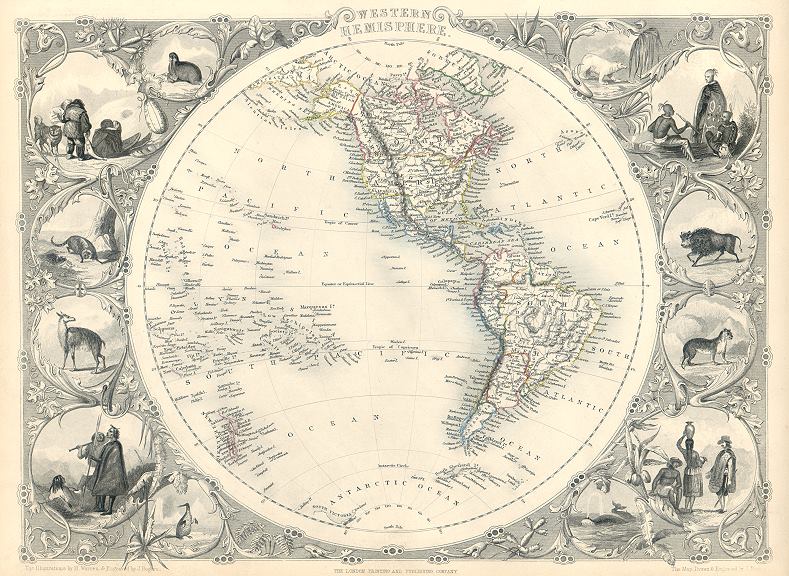
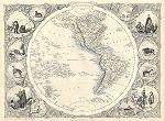 "Western Hemisphere" drawn and engraved by J.Rapkin, published by The London Printing and Publishing Company, about 1853. The original is a decorative steel engraved map with original
hand colouring. Click
here for detail showing part
of the map at full resolution (400 dpi). Click the small image to the left for a larger low resolution version. (Ref sm0162). Digital image
21.6mb at 400dpi. "Western Hemisphere" drawn and engraved by J.Rapkin, published by The London Printing and Publishing Company, about 1853. The original is a decorative steel engraved map with original
hand colouring. Click
here for detail showing part
of the map at full resolution (400 dpi). Click the small image to the left for a larger low resolution version. (Ref sm0162). Digital image
21.6mb at 400dpi.
Price 5 USD, Click here to buy
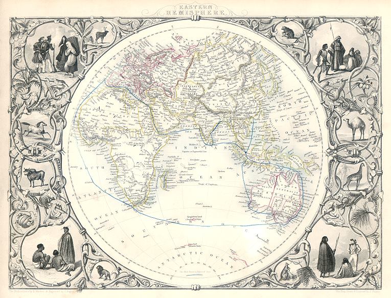
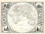 "Eastern Hemisphere" drawn and engraved by J.Rapkin, published by The London Printing and Publishing Company, about 1853. The original is a decorative steel engraved map with original
hand colouring. Click
here for detail showing part
of the map at full resolution (400 dpi). Click the small image to the left for a larger low resolution version. (Ref sm0162). Digital image
18.1mb at 400dpi. "Eastern Hemisphere" drawn and engraved by J.Rapkin, published by The London Printing and Publishing Company, about 1853. The original is a decorative steel engraved map with original
hand colouring. Click
here for detail showing part
of the map at full resolution (400 dpi). Click the small image to the left for a larger low resolution version. (Ref sm0162). Digital image
18.1mb at 400dpi.
Price 5 USD, Click here to buy
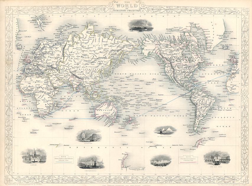
 "The World on Mercators Projection" (Tallis map) drawn and engraved by J.Rapkin, published by The London Printing and Publishing Company, about 1853. The original is a steel engraved map with original
hand colouring. Click
here for detail showing part
of the map at full resolution (400 dpi). Click the small image to the left for a larger low resolution version. (Ref sm0217). Digital image
20.4mb at 400dpi. "The World on Mercators Projection" (Tallis map) drawn and engraved by J.Rapkin, published by The London Printing and Publishing Company, about 1853. The original is a steel engraved map with original
hand colouring. Click
here for detail showing part
of the map at full resolution (400 dpi). Click the small image to the left for a larger low resolution version. (Ref sm0217). Digital image
20.4mb at 400dpi.
Price 5 USD, Click here to buy
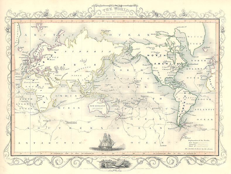
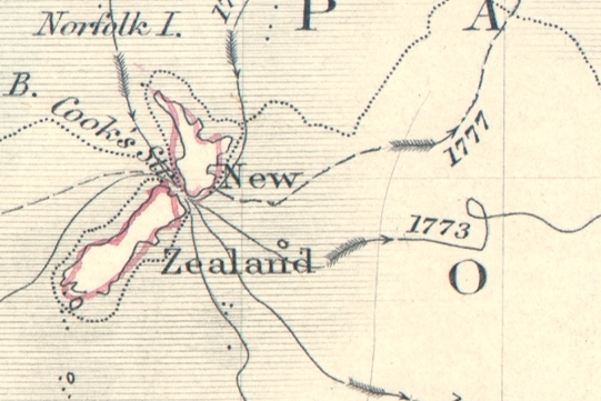
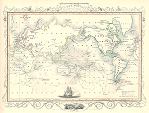 "The World on Mercators Projection Showing the Voyages of Captain Cook around the World" (Tallis map) drawn and engraved by J.Rapkin, published by The London Printing and Publishing Company, about 1853. The original is a steel engraved map with original
hand colouring, Cook's several voyages are shown with dated routes. Click
here for detail showing part
of the map at full resolution (400 dpi). Click the small image to the left for a larger low resolution version. (Ref sm0157). Digital image
15.8mb at 400dpi. "The World on Mercators Projection Showing the Voyages of Captain Cook around the World" (Tallis map) drawn and engraved by J.Rapkin, published by The London Printing and Publishing Company, about 1853. The original is a steel engraved map with original
hand colouring, Cook's several voyages are shown with dated routes. Click
here for detail showing part
of the map at full resolution (400 dpi). Click the small image to the left for a larger low resolution version. (Ref sm0157). Digital image
15.8mb at 400dpi.
Price 5 USD, Click here to buy
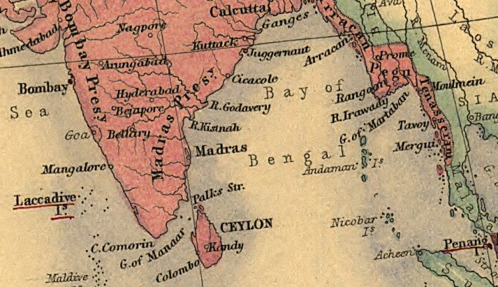
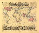 "
British Empire Throughout the World Exhibited in One View " engraved by J.Bartholomew & J.Thom, published in Fullarton's
Royal Illustrated Atlas, about 1864. The original is a steel engraved map
with original hand colouring. Click
here for detail showing part
of the map at full resolution (India) (300 dpi). Click the small image
to the left for a larger low resolution version. (Ref sm0092). Digital image
32.5mb at 300dpi. "
British Empire Throughout the World Exhibited in One View " engraved by J.Bartholomew & J.Thom, published in Fullarton's
Royal Illustrated Atlas, about 1864. The original is a steel engraved map
with original hand colouring. Click
here for detail showing part
of the map at full resolution (India) (300 dpi). Click the small image
to the left for a larger low resolution version. (Ref sm0092). Digital image
32.5mb at 300dpi.
Price 5 USD, Click here to buy
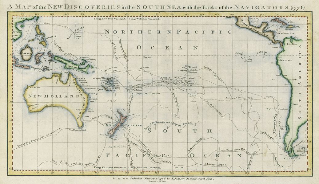
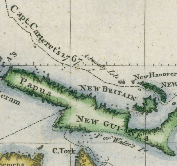
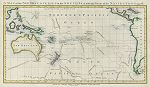 "
A Map of the New Discoveries in the South Sea, with the Tracks of the Navigators. (1778) " engraved by Mr.Smith, published in
Fenning's A New System of Geography ..., 1778. The original is a copper engraved map
with recent hand colouring. Click here for detail showing part
of the map at full resolution (400 dpi). Click the small image
to the left for a larger low resolution version. (Ref sm0232). Digital image
14.2mb at 400dpi. "
A Map of the New Discoveries in the South Sea, with the Tracks of the Navigators. (1778) " engraved by Mr.Smith, published in
Fenning's A New System of Geography ..., 1778. The original is a copper engraved map
with recent hand colouring. Click here for detail showing part
of the map at full resolution (400 dpi). Click the small image
to the left for a larger low resolution version. (Ref sm0232). Digital image
14.2mb at 400dpi.
Price 5 USD, Click here to buy
-tn.jpg) "The Solar System, Theory of the Seasons, Eclipses, Phases of the Moon, Theory of the Tides, Mariner's Compas" published in Black's General Atlas of the World, 1898. The original is a chromolithograph (early type of colour print). Click
here for detail showing part
of the chart at full resolution (400 dpi). Click the small image
to the left for a larger low resolution version. (Ref sm0136). Digital image
21mb at 400dpi. "The Solar System, Theory of the Seasons, Eclipses, Phases of the Moon, Theory of the Tides, Mariner's Compas" published in Black's General Atlas of the World, 1898. The original is a chromolithograph (early type of colour print). Click
here for detail showing part
of the chart at full resolution (400 dpi). Click the small image
to the left for a larger low resolution version. (Ref sm0136). Digital image
21mb at 400dpi.
Price 5 USD, Click here to buy
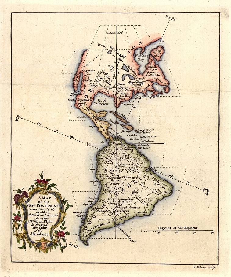
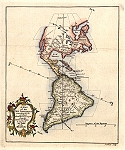 "
A Map of the New Continent ... " engraved by J.Gibson, published in The
Gentleman's Magazine, 1758. The original is a copper engraved map with
recent hand colouring. Click
here for detail showing part
of the map at full resolution (600 dpi). Click the small image
to the left for a larger low resolution version. (Ref sm0006). Digital
image size 20mb at 600 dpi. "
A Map of the New Continent ... " engraved by J.Gibson, published in The
Gentleman's Magazine, 1758. The original is a copper engraved map with
recent hand colouring. Click
here for detail showing part
of the map at full resolution (600 dpi). Click the small image
to the left for a larger low resolution version. (Ref sm0006). Digital
image size 20mb at 600 dpi.
Price 5
USD, Click here to buy
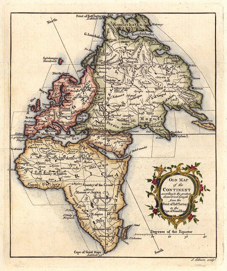
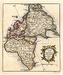 "
Old Map of the Continent ... " engraved by J.Gibson, published in The
Gentleman's Magazine, 1758. The original is a copper engraved map with
recent hand colouring. Click
here for detail showing part
of the map at full resolution (600 dpi). Click the small image
to the left for a larger low resolution version. (Ref sm0007). Digital
image size 20mb at 600 dpi.(Of interest is the engraver's mistake in the title,
which should be " Map of the Old Continent ... ") "
Old Map of the Continent ... " engraved by J.Gibson, published in The
Gentleman's Magazine, 1758. The original is a copper engraved map with
recent hand colouring. Click
here for detail showing part
of the map at full resolution (600 dpi). Click the small image
to the left for a larger low resolution version. (Ref sm0007). Digital
image size 20mb at 600 dpi.(Of interest is the engraver's mistake in the title,
which should be " Map of the Old Continent ... ")
Price 5
USD, Click here to buy
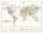 "The
Geological Structure of the Globe, according to Ami Boue" by A.K.Johnston, published in
1850 in Johnston's Physical Atlas. The original is a steel engraved map
with original hand colouring. Click
here for detail showing part
of the map at full resolution (800 dpi). Click the small image
to the left for a larger low resolution version. (Ref sm0011). Digital image
34mb at 800dpi. "The
Geological Structure of the Globe, according to Ami Boue" by A.K.Johnston, published in
1850 in Johnston's Physical Atlas. The original is a steel engraved map
with original hand colouring. Click
here for detail showing part
of the map at full resolution (800 dpi). Click the small image
to the left for a larger low resolution version. (Ref sm0011). Digital image
34mb at 800dpi.
Price 5 USD, Click here to buy
_tn.jpg) "Meteorological
Map of the World Showing the Distribution of the Temperature of the Air" (Global Warming interest) engraved by J.Dower
after a map by A.Petermann, published by Orr & Company about 1855. The original is a steel engraved map
with original hand colouring. Click
here for detail showing part
of the map at full resolution (500 dpi). Click the small image
to the left for a larger low resolution version. (Ref sm0025). Digital image
13mb at 500dpi. "Meteorological
Map of the World Showing the Distribution of the Temperature of the Air" (Global Warming interest) engraved by J.Dower
after a map by A.Petermann, published by Orr & Company about 1855. The original is a steel engraved map
with original hand colouring. Click
here for detail showing part
of the map at full resolution (500 dpi). Click the small image
to the left for a larger low resolution version. (Ref sm0025). Digital image
13mb at 500dpi.
Price 5 USD, Click here to buy
_tn.jpg) "Ethnographic
Map of the World Showing the Present Distribution of the Leading Races of Man " by A.K.Johnston, published in Johnston's Physical Atlas, about 1850. The original is a steel engraved map
with original hand colouring. Click
here for detail showing part
of the map at full resolution (600 dpi). Click the small image
to the left for a larger low resolution version. (Ref sm0036). Digital image
23mb at 600dpi. "Ethnographic
Map of the World Showing the Present Distribution of the Leading Races of Man " by A.K.Johnston, published in Johnston's Physical Atlas, about 1850. The original is a steel engraved map
with original hand colouring. Click
here for detail showing part
of the map at full resolution (600 dpi). Click the small image
to the left for a larger low resolution version. (Ref sm0036). Digital image
23mb at 600dpi.
Price 5 USD, Click here to buy
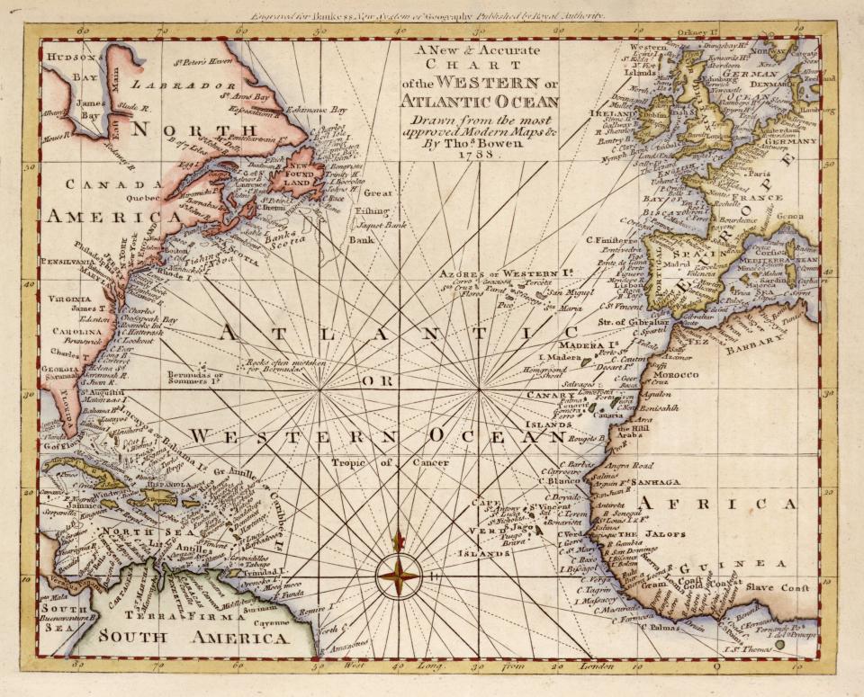
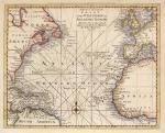 "A
New and Accurate Chart of the Western or Atlantic Ocean, drawn from the most
Approved Modern Maps &c. by Thos. Bowen, 1788" published in
1788 in Thomas Bankes's New .. System of Universal Geography, London, about 1788. The original is a copper engraved map
with recent hand colouring. Click
here for detail showing part
of the map at full resolution (800 dpi). Click the small image
to the left for a larger low resolution version. (Ref sm0018). Digital image
34mb at 800dpi. "A
New and Accurate Chart of the Western or Atlantic Ocean, drawn from the most
Approved Modern Maps &c. by Thos. Bowen, 1788" published in
1788 in Thomas Bankes's New .. System of Universal Geography, London, about 1788. The original is a copper engraved map
with recent hand colouring. Click
here for detail showing part
of the map at full resolution (800 dpi). Click the small image
to the left for a larger low resolution version. (Ref sm0018). Digital image
34mb at 800dpi.
Price 5 USD, Click here to buy
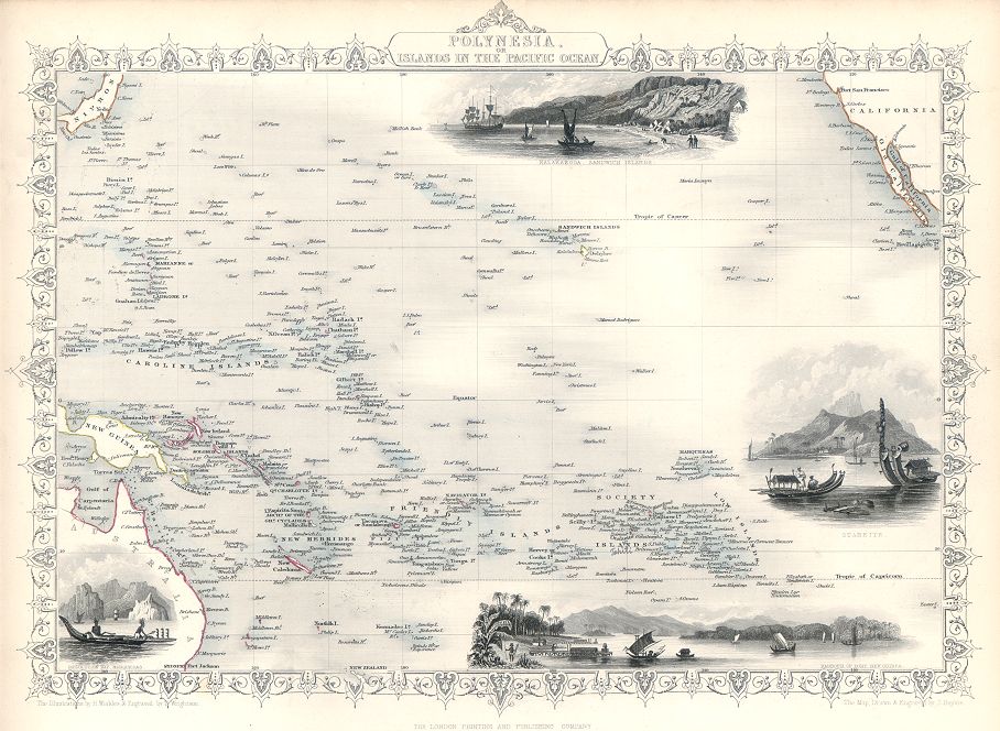
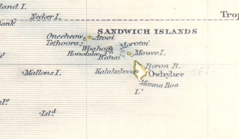
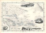 "Polynesia, or Islands in the Pacific Ocean" drawn and engraved by J.Rapkin, published in Tallis's The Illustrated Atlas ..., about 1853. The original is a decorative steel engraved map with original
hand colouring, the decorative vignettes include Kalakakooa in the Sandwich Islands (Hawaii), Otaheite, Resolution Bay in Marquesas and Harbour of Dory in New Guinea. Click
here for detail showing part
of the map at full resolution (400 dpi). Click the small image to the left for a larger low resolution version. (Ref sm0258). Digital image
16.8mb at 400dpi. "Polynesia, or Islands in the Pacific Ocean" drawn and engraved by J.Rapkin, published in Tallis's The Illustrated Atlas ..., about 1853. The original is a decorative steel engraved map with original
hand colouring, the decorative vignettes include Kalakakooa in the Sandwich Islands (Hawaii), Otaheite, Resolution Bay in Marquesas and Harbour of Dory in New Guinea. Click
here for detail showing part
of the map at full resolution (400 dpi). Click the small image to the left for a larger low resolution version. (Ref sm0258). Digital image
16.8mb at 400dpi.
Price 5 USD, Click here to buy
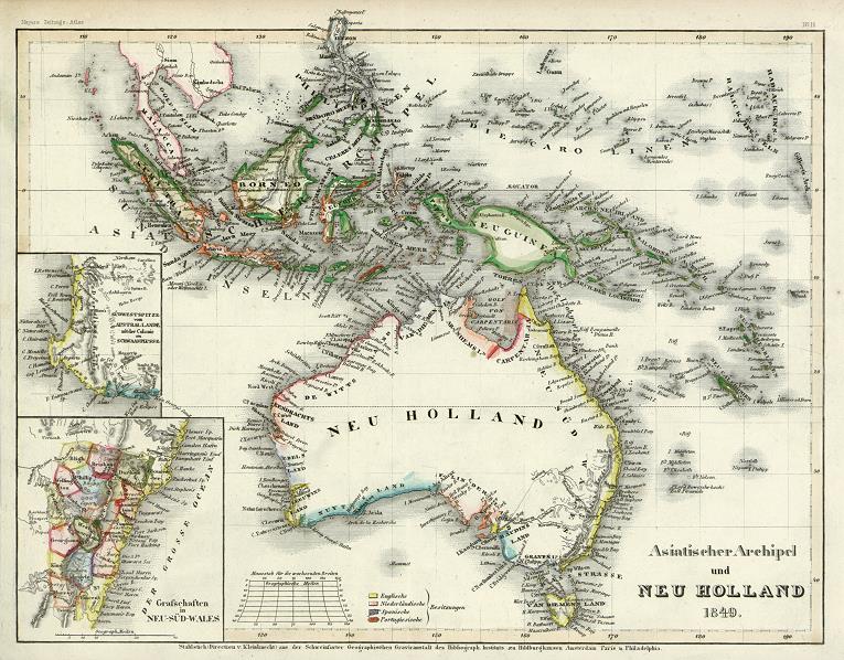
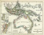 "Asiatischer Archipel und Neu Holland 1849" (Australia and East Indies in 1849) the original is a steel engraved map with original hand colouring, published in Illustrationen zu Meyer's Neuem Konversations-Lexicon, 1849. Small inset maps of the Sydney and Perth areas. Click
here for detail showing part of the map at full resolution (500 dpi). Click the small image
to the left for a larger low resolution version. (Ref sm0242). Digital
image size 16.5 mb at 500 dpi. "Asiatischer Archipel und Neu Holland 1849" (Australia and East Indies in 1849) the original is a steel engraved map with original hand colouring, published in Illustrationen zu Meyer's Neuem Konversations-Lexicon, 1849. Small inset maps of the Sydney and Perth areas. Click
here for detail showing part of the map at full resolution (500 dpi). Click the small image
to the left for a larger low resolution version. (Ref sm0242). Digital
image size 16.5 mb at 500 dpi.
Price 5
USD, Click here to buy
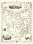
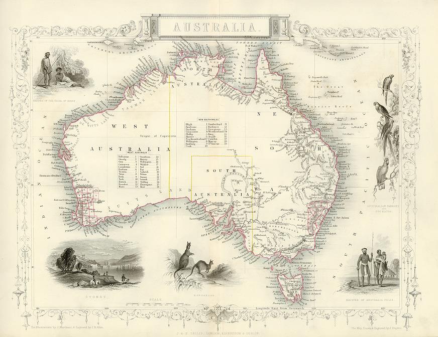
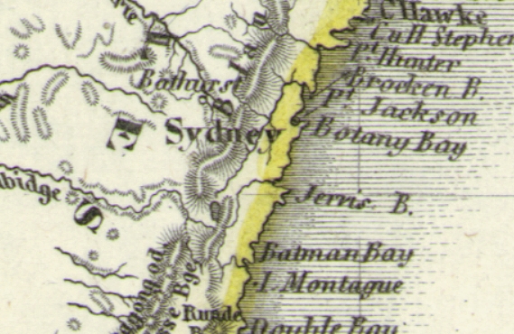
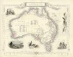 "Australia" drawn and engraved by J.Rapkin, published in Tallis's illustrated Atlas ..., 1851. The original is a detailed steel engraved map with original hand colouring and a centrefold which is just visible on the image. Small inset views of Sydney, Aborigines and wildlife. Click
here for detail showing the Adelaide area at full resolution (400 dpi). Click the small image
to the left for a larger low resolution version. (Ref sm0068). Digital
image size 15.5 mb at 400 dpi. "Australia" drawn and engraved by J.Rapkin, published in Tallis's illustrated Atlas ..., 1851. The original is a detailed steel engraved map with original hand colouring and a centrefold which is just visible on the image. Small inset views of Sydney, Aborigines and wildlife. Click
here for detail showing the Adelaide area at full resolution (400 dpi). Click the small image
to the left for a larger low resolution version. (Ref sm0068). Digital
image size 15.5 mb at 400 dpi.
Price 5
USD, Click here to buy
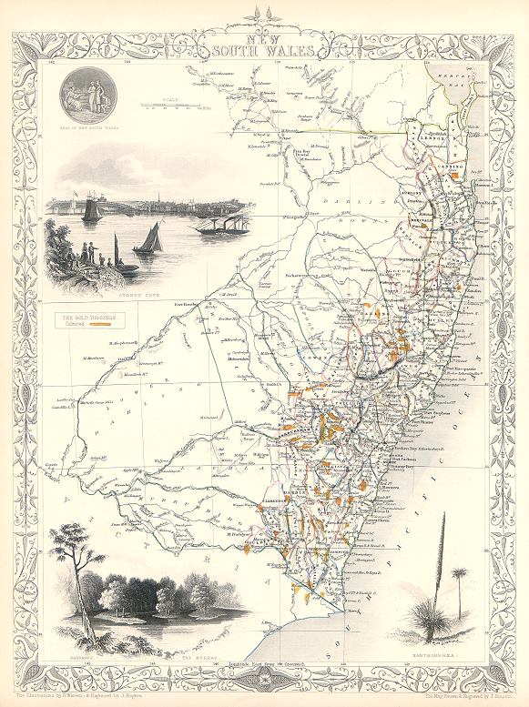
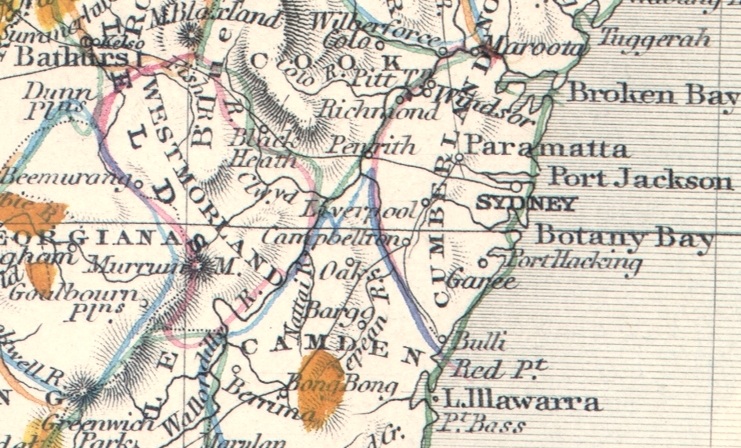
 "New South Wales" drawn and engraved by J.Rapkin, published by The London Printing and Publishing Company, about 1853. The original is a decorative steel engraved map with original
hand colouring, including orange highlighting to show the 'Gold Diggings'. Click
here for detail showing part
of the map at full resolution (400 dpi). Click the small image to the left for a larger low resolution version. (Ref sm0165). Digital image
18.4mb at 400dpi. "New South Wales" drawn and engraved by J.Rapkin, published by The London Printing and Publishing Company, about 1853. The original is a decorative steel engraved map with original
hand colouring, including orange highlighting to show the 'Gold Diggings'. Click
here for detail showing part
of the map at full resolution (400 dpi). Click the small image to the left for a larger low resolution version. (Ref sm0165). Digital image
18.4mb at 400dpi.
Price 5 USD, Click here to buy
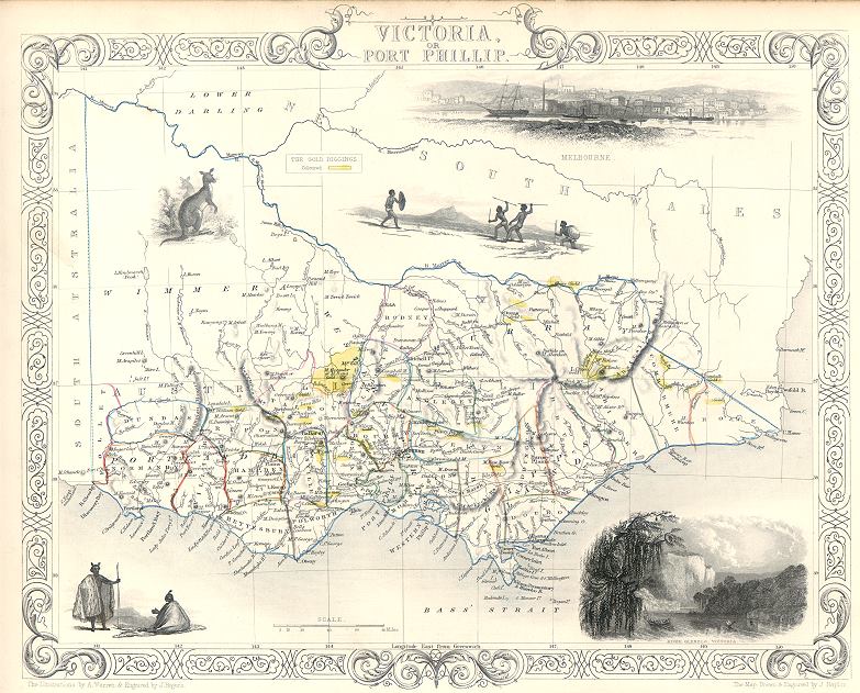
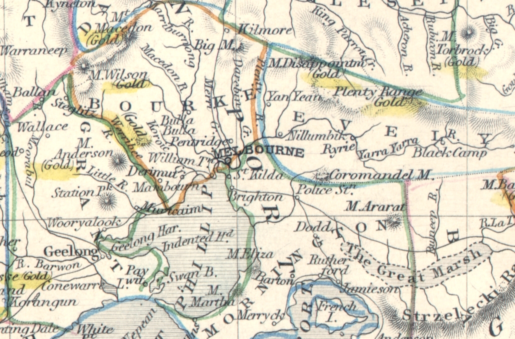
 "Victoria or Port Phillip" drawn and engraved by J.Rapkin, published by The London Printing and Publishing Company, about 1853. The original is a decorative steel engraved map with original
hand colouring, including yellow highlighting to show the 'Gold Diggings'. Click
here for detail showing part
of the map at full resolution (400 dpi). Click the small image to the left for a larger low resolution version. (Ref sm0164). Digital image
15.3mb at 400dpi. "Victoria or Port Phillip" drawn and engraved by J.Rapkin, published by The London Printing and Publishing Company, about 1853. The original is a decorative steel engraved map with original
hand colouring, including yellow highlighting to show the 'Gold Diggings'. Click
here for detail showing part
of the map at full resolution (400 dpi). Click the small image to the left for a larger low resolution version. (Ref sm0164). Digital image
15.3mb at 400dpi.
Price 5 USD, Click here to buy
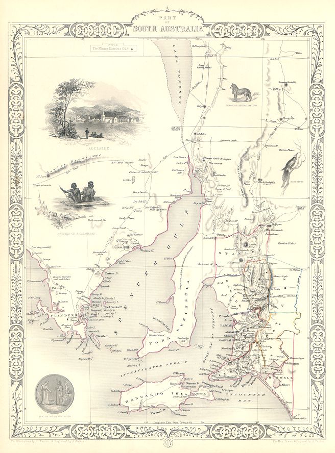
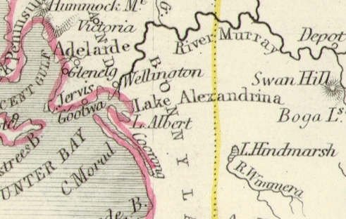
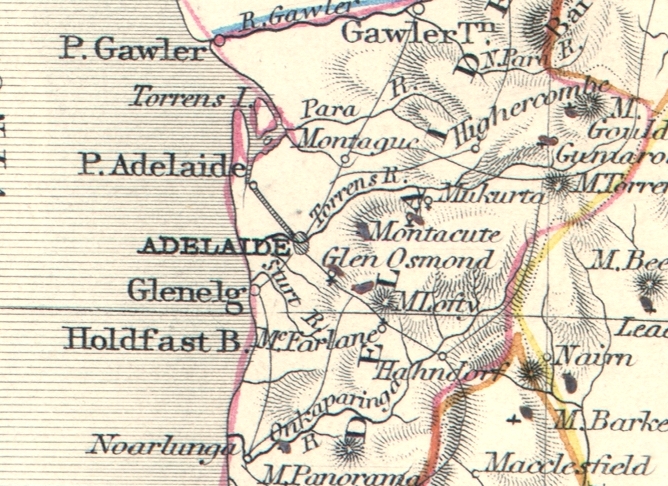
 "Part of South Australia" drawn and engraved by J.Rapkin, published in Tallis's The Illustrated Atlas ..., about 1853. The original is a decorative steel engraved map with original
hand colouring and centrefold, the decorative vignettes include Adelaide and Seal of the Colony. Small black dots mark the 'Mining Districts'. Click
here for detail showing part
of the map at full resolution (400 dpi). Click the small image to the left for a larger low resolution version. (Ref sm0248). Digital image
17.4mb at 400dpi. "Part of South Australia" drawn and engraved by J.Rapkin, published in Tallis's The Illustrated Atlas ..., about 1853. The original is a decorative steel engraved map with original
hand colouring and centrefold, the decorative vignettes include Adelaide and Seal of the Colony. Small black dots mark the 'Mining Districts'. Click
here for detail showing part
of the map at full resolution (400 dpi). Click the small image to the left for a larger low resolution version. (Ref sm0248). Digital image
17.4mb at 400dpi.
Price 5 USD, Click here to buy
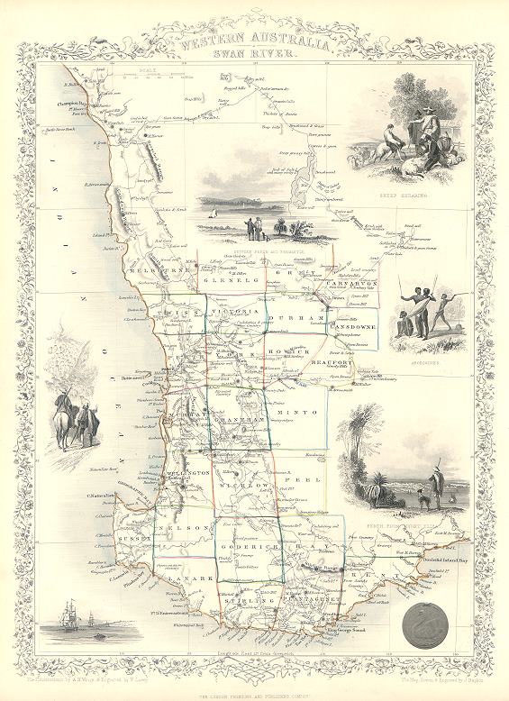
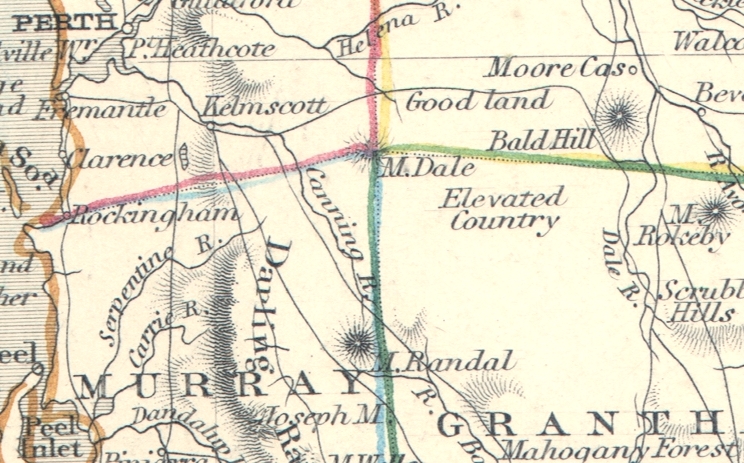
 "Western Australia, Swan River" (with Perth) drawn and engraved by J.Rapkin, published by The London Printing and Publishing Company, about 1853. The original is a decorative steel engraved map with original
hand colouring. Click
here for detail showing part
of the map at full resolution (400 dpi). Click the small image to the left for a larger low resolution version. (Ref sm0168). Digital image
17.6mb at 400dpi. "Western Australia, Swan River" (with Perth) drawn and engraved by J.Rapkin, published by The London Printing and Publishing Company, about 1853. The original is a decorative steel engraved map with original
hand colouring. Click
here for detail showing part
of the map at full resolution (400 dpi). Click the small image to the left for a larger low resolution version. (Ref sm0168). Digital image
17.6mb at 400dpi.
Price 5 USD, Click here to buy
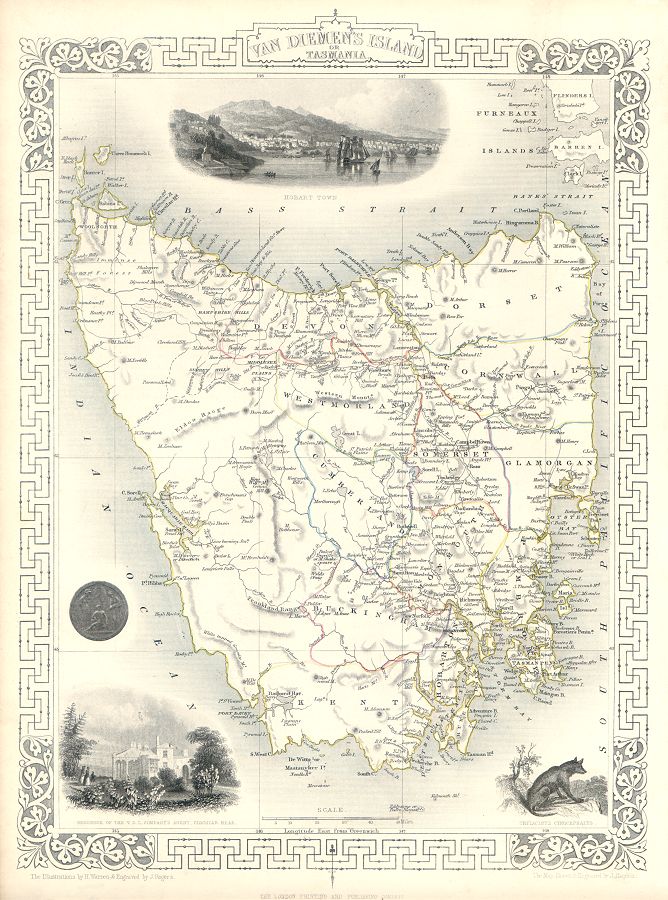
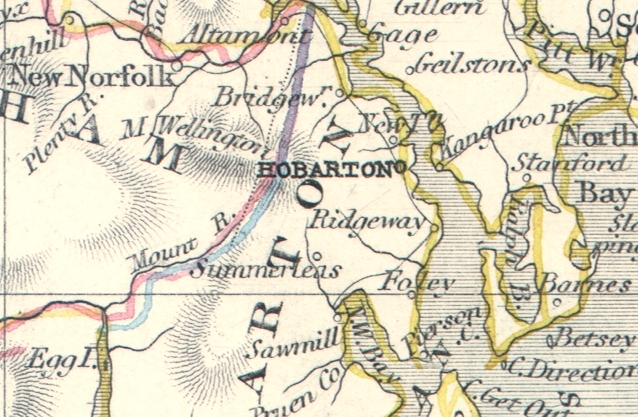
 "Van Dieman's Island, or Tasmania" drawn and engraved by J.Rapkin, published in Tallis's The Illustrated Atlas ..., about 1853. The original is a decorative steel engraved map with original
hand colouring. The decorative vignettes include Hobart Town, Thylacinus Cynocephalus and Seal of the Colony. Click
here for detail showing part
of the map at full resolution (400 dpi). Click the small image to the left for a larger low resolution version. (Ref sm0249). Digital image
19.7mb at 400dpi. "Van Dieman's Island, or Tasmania" drawn and engraved by J.Rapkin, published in Tallis's The Illustrated Atlas ..., about 1853. The original is a decorative steel engraved map with original
hand colouring. The decorative vignettes include Hobart Town, Thylacinus Cynocephalus and Seal of the Colony. Click
here for detail showing part
of the map at full resolution (400 dpi). Click the small image to the left for a larger low resolution version. (Ref sm0249). Digital image
19.7mb at 400dpi.
Price 5 USD, Click here to buy
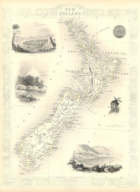
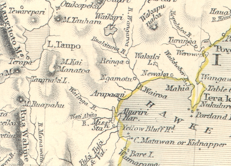
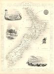 "New Zealand" drawn and engraved by J.Rapkin, published by The London Printing and Publishing Company, about 1853. The original is a decorative steel engraved map with original
hand colouring. Click
here for detail showing part
of the map at full resolution (400 dpi). Click the small image to the left for a larger low resolution version. (Ref sm0199). Digital image
18.9mb at 400dpi. "New Zealand" drawn and engraved by J.Rapkin, published by The London Printing and Publishing Company, about 1853. The original is a decorative steel engraved map with original
hand colouring. Click
here for detail showing part
of the map at full resolution (400 dpi). Click the small image to the left for a larger low resolution version. (Ref sm0199). Digital image
18.9mb at 400dpi.
Price 5 USD, Click here to buy
_tn.jpg) "Chart of the Antarctic Polar Circle, with the Countries adjoining, According to the New Hypothesis of M.Buache. From the Memoirs of the Royal Academy at Paris " published in
1788 in The Gentleman's Magazine, London, 1763. The original is a copper engraved map. Click
here for detail showing part
of the map at full resolution (500 dpi). Click the small image
to the left for a larger low resolution version. (Ref sm0049). Digital image
12mb at 500dpi. "Chart of the Antarctic Polar Circle, with the Countries adjoining, According to the New Hypothesis of M.Buache. From the Memoirs of the Royal Academy at Paris " published in
1788 in The Gentleman's Magazine, London, 1763. The original is a copper engraved map. Click
here for detail showing part
of the map at full resolution (500 dpi). Click the small image
to the left for a larger low resolution version. (Ref sm0049). Digital image
12mb at 500dpi.
Price 5 USD, Click here to buy
|
|

.jpg)
-l.jpg)
.jpg)
.jpg)
.jpg)
.jpg)
-d.jpg)
-d.jpg)
-d.jpg)
-d.jpg)
-d.jpg)