|
Home
Catalogue
Information
Copyright
Other Stock Image websites

Some of these maps and plans are now available at Mapseeker as photo or giclee prints -

|
Latest additions -
Notre Dame, Paris, 1840
Essex map, 1809
Eastern USA map, 1852
Calcutta view, 1850
Bohemia map, 1773
Dardanelles view, Turkey, 1828
Baltic Sea Tallis map, 1860
Plan of medieval Paris, 1884
Istanbul view, 1770
Cambridgeshire map, 1809
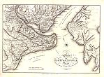
Basra environs map, 1757
Suffolk map, 1806
Ancient Sicily map, 1745
Isle of Wight map, 1806
Ancient Greece map, 1745 |
Download Royalty-free Stock Images of antique historical city plans
(for UK city plans see here)
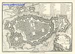
_tn.jpg) Ireland "
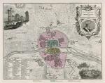
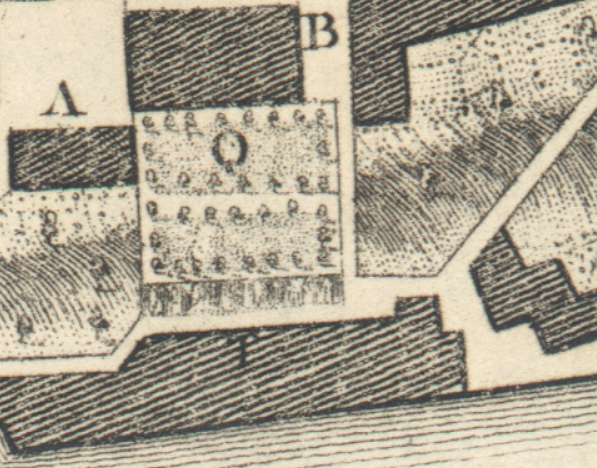
Plan of Dublin " anonymous engraver, published
in History of the City of Dublin,
1818. The original is a copper engraved plan
measuring 37 x 25 cms, it has three vertical folds, one of which is visible
in the image. Click
here for detail showing part
of the map at full resolution (500 dpi). Click the small image
to the left for a larger low resolution version. (Ref sm0014). Digital
image size 29 mb at 500 dpi. Ireland "
Plan of Dublin " anonymous engraver, published
in History of the City of Dublin,
1818. The original is a copper engraved plan
measuring 37 x 25 cms, it has three vertical folds, one of which is visible
in the image. Click
here for detail showing part
of the map at full resolution (500 dpi). Click the small image
to the left for a larger low resolution version. (Ref sm0014). Digital
image size 29 mb at 500 dpi.
Price 5
USD, Click here to buy
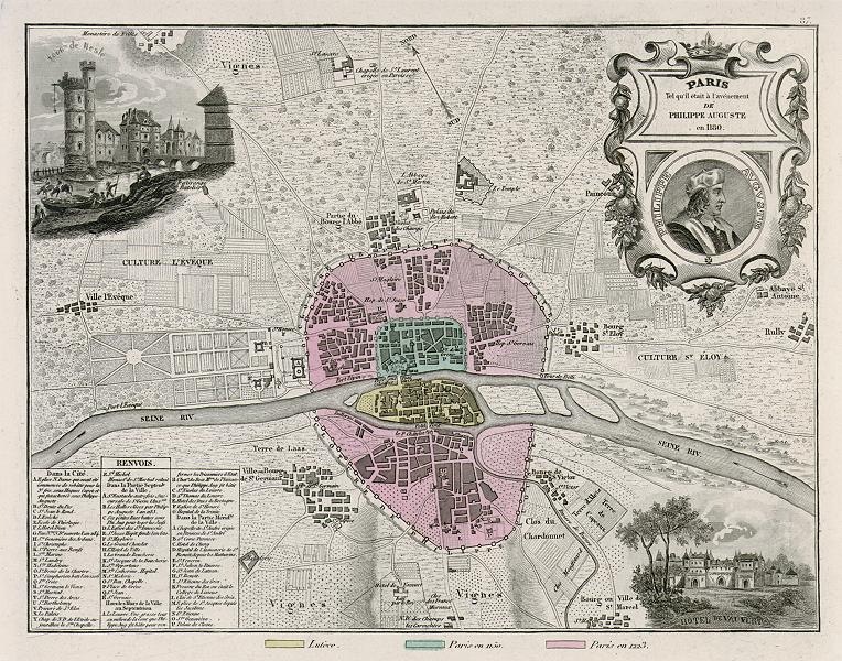
 "Paris Tel qu'il etait a l'avenement de Philippe Auguste en 1180" (Medieval Paris in 1180) city plan published in France et Ses Colonies, 1884. The original is a steel engraving with original hand colour. Click
here for detail showing part
of the map at full resolution (500 dpi). Click the small image
to the left for a larger low resolution version. (Ref sm0270). Digital
image size 16.5 mb at 500 dpi. "Paris Tel qu'il etait a l'avenement de Philippe Auguste en 1180" (Medieval Paris in 1180) city plan published in France et Ses Colonies, 1884. The original is a steel engraving with original hand colour. Click
here for detail showing part
of the map at full resolution (500 dpi). Click the small image
to the left for a larger low resolution version. (Ref sm0270). Digital
image size 16.5 mb at 500 dpi.
Price 5
USD, Click here to buy
_tn.jpg) "A Plan of the City of Paris" detailed copper engraved city plan by John Andrews, first published in Plans of the Principal Cities in the World, about 1776. This example was published by by John Stockdale in 1800. The original
measures about 26 x 23 cms. Click
here for detail showing part
of the map at full resolution (500 dpi). Click the small image
to the left for a larger low resolution version. (Ref sm0122). Digital
image size 24.1 mb at 500 dpi. "A Plan of the City of Paris" detailed copper engraved city plan by John Andrews, first published in Plans of the Principal Cities in the World, about 1776. This example was published by by John Stockdale in 1800. The original
measures about 26 x 23 cms. Click
here for detail showing part
of the map at full resolution (500 dpi). Click the small image
to the left for a larger low resolution version. (Ref sm0122). Digital
image size 24.1 mb at 500 dpi.
Price 5
USD, Click here to buy
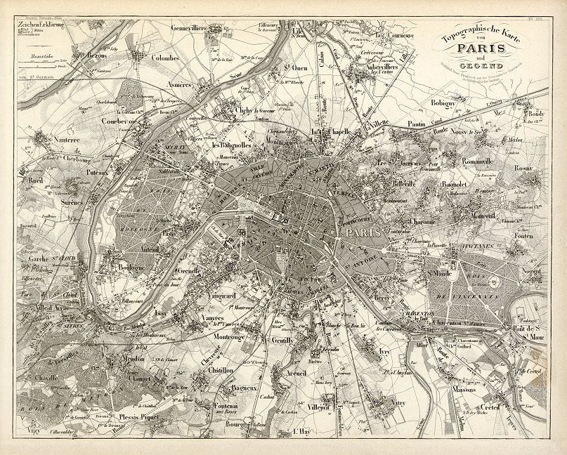
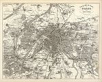 "Topographische Karte von Paris und Gegend" (map of Paris and environs) detailed steel engraved city plan from the Schweinfurter Geograph. Graviranstalt for Neuster Zeitungs Atlas. Alter und Neuer Erdkunde by J. Meyer, about 1855. Map shows a street plan of Paris surrounded by its many suburbs. In the upper left corner is Bezous on the Seine and in the lower left corner is Chaville. Créteil is in the lower right corner and Body is under the title in the upper right corner. Click
here for detail showing part
of the map at full resolution (500 dpi). Click the small image
to the left for a larger low resolution version. (Ref sm0255). Digital
image size 21.9 mb at 500 dpi. "Topographische Karte von Paris und Gegend" (map of Paris and environs) detailed steel engraved city plan from the Schweinfurter Geograph. Graviranstalt for Neuster Zeitungs Atlas. Alter und Neuer Erdkunde by J. Meyer, about 1855. Map shows a street plan of Paris surrounded by its many suburbs. In the upper left corner is Bezous on the Seine and in the lower left corner is Chaville. Créteil is in the lower right corner and Body is under the title in the upper right corner. Click
here for detail showing part
of the map at full resolution (500 dpi). Click the small image
to the left for a larger low resolution version. (Ref sm0255). Digital
image size 21.9 mb at 500 dpi.
Price 5
USD, Click here to buy
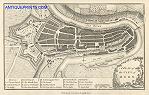
_tn.jpg) Valletta "A Plan of the City of Malta" detailed copper engraved city plan by John Andrews, first published in Plans of the Principal Cities in the World, about 1776. This example was published by by John Stockdale in 1800. The original
measures about 26 x 17.5 cms. Click
here for detail showing part
of the map at full resolution (500 dpi). Click the small image
to the left for a larger low resolution version. (Ref sm0078). Digital
image size 17.5 mb at 500 dpi. Valletta "A Plan of the City of Malta" detailed copper engraved city plan by John Andrews, first published in Plans of the Principal Cities in the World, about 1776. This example was published by by John Stockdale in 1800. The original
measures about 26 x 17.5 cms. Click
here for detail showing part
of the map at full resolution (500 dpi). Click the small image
to the left for a larger low resolution version. (Ref sm0078). Digital
image size 17.5 mb at 500 dpi.
Price 5
USD, Click here to buy
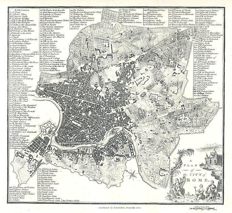
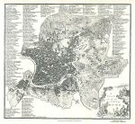 Italy "A Plan of the City of Rome " detailed copper engraved city plan by John Andrews, first published in Plans of the Principal Cities in the World, about 1776. This example was published by by John Stockdale in 1800. The original
measures about 25.5 x 24 cms. Click
here for detail showing part
of the map at full resolution (500 dpi). Click the small image
to the left for a larger low resolution version. (Ref sm0081). Digital
image size 24 mb at 500 dpi. Italy "A Plan of the City of Rome " detailed copper engraved city plan by John Andrews, first published in Plans of the Principal Cities in the World, about 1776. This example was published by by John Stockdale in 1800. The original
measures about 25.5 x 24 cms. Click
here for detail showing part
of the map at full resolution (500 dpi). Click the small image
to the left for a larger low resolution version. (Ref sm0081). Digital
image size 24 mb at 500 dpi.
Price 5
USD, Click here to buy
_tn.jpg) Italy "A Plan of the City of Venice" detailed copper engraved city plan by John Andrews, first published in Plans of the Principal Cities in the World, about 1776. This example was published by by John Stockdale in 1800. The original
measures about 25.5 x 18 cms. Click
here for detail showing part
of the map at full resolution (500 dpi). Click the small image
to the left for a larger low resolution version. (Ref sm0095). Digital
image size 16.5 mb at 500 dpi. Italy "A Plan of the City of Venice" detailed copper engraved city plan by John Andrews, first published in Plans of the Principal Cities in the World, about 1776. This example was published by by John Stockdale in 1800. The original
measures about 25.5 x 18 cms. Click
here for detail showing part
of the map at full resolution (500 dpi). Click the small image
to the left for a larger low resolution version. (Ref sm0095). Digital
image size 16.5 mb at 500 dpi.
Price 5
USD, Click here to buy
_tn.jpg) Italy "A Plan of the City of Naples" (Napoli) detailed copper engraved city plan by John Andrews, first published in Plans of the Principal Cities in the World, about 1776. This example was published by by John Stockdale in 1800. The original
measures about 25 x 16.5 cms. Click
here for detail showing part
of the map at full resolution (500 dpi). Click the small image
to the left for a larger low resolution version. (Ref sm0072). Digital
image size 16.5 mb at 500 dpi. Italy "A Plan of the City of Naples" (Napoli) detailed copper engraved city plan by John Andrews, first published in Plans of the Principal Cities in the World, about 1776. This example was published by by John Stockdale in 1800. The original
measures about 25 x 16.5 cms. Click
here for detail showing part
of the map at full resolution (500 dpi). Click the small image
to the left for a larger low resolution version. (Ref sm0072). Digital
image size 16.5 mb at 500 dpi.
Price 5
USD, Click here to buy
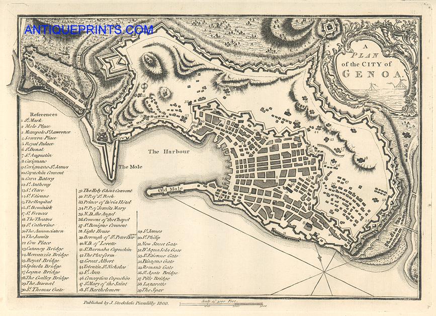
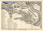 Italy "A Plan of the City of Genoa" detailed copper engraved city plan by John Andrews, first published in Plans of the Principal Cities in the World, about 1776. This example was published by by John Stockdale in 1800. The original
measures about 25.5 x 18.5 cms. Click
here for detail showing part
of the map at full resolution (500 dpi). Click the small image
to the left for a larger low resolution version. (Ref sm0184). Digital
image size 19 mb at 500 dpi. Italy "A Plan of the City of Genoa" detailed copper engraved city plan by John Andrews, first published in Plans of the Principal Cities in the World, about 1776. This example was published by by John Stockdale in 1800. The original
measures about 25.5 x 18.5 cms. Click
here for detail showing part
of the map at full resolution (500 dpi). Click the small image
to the left for a larger low resolution version. (Ref sm0184). Digital
image size 19 mb at 500 dpi.
Price 5
USD, Click here to buy
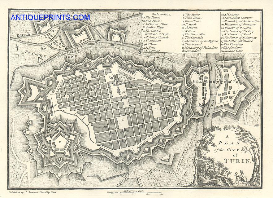
 Italy "A Plan of the City of Turin" detailed copper engraved city plan by John Andrews, first published in Plans of the Principal Cities in the World, about 1776. This example was published by by John Stockdale in 1800. The original
measures about 24.5 x 18 cms. Click
here for detail showing part
of the map at full resolution (500 dpi). Click the small image
to the left for a larger low resolution version. (Ref sm0185). Digital
image size 17 mb at 500 dpi. Italy "A Plan of the City of Turin" detailed copper engraved city plan by John Andrews, first published in Plans of the Principal Cities in the World, about 1776. This example was published by by John Stockdale in 1800. The original
measures about 24.5 x 18 cms. Click
here for detail showing part
of the map at full resolution (500 dpi). Click the small image
to the left for a larger low resolution version. (Ref sm0185). Digital
image size 17 mb at 500 dpi.
Price 5
USD, Click here to buy
_tn.jpg) Netherlands "A Plan of the City of Amsterdam" detailed copper engraved city plan by John Andrews, first published in Plans of the Principal Cities in the World, about 1776. This example was published by by John Stockdale in 1800. The original
measures about 25 x 16.5 cms. Click
here for detail showing part
of the map at full resolution (500 dpi). Click the small image
to the left for a larger low resolution version. (Ref sm0073). Digital
image size 19 mb at 500 dpi. Netherlands "A Plan of the City of Amsterdam" detailed copper engraved city plan by John Andrews, first published in Plans of the Principal Cities in the World, about 1776. This example was published by by John Stockdale in 1800. The original
measures about 25 x 16.5 cms. Click
here for detail showing part
of the map at full resolution (500 dpi). Click the small image
to the left for a larger low resolution version. (Ref sm0073). Digital
image size 19 mb at 500 dpi.
Price 5
USD, Click here to buy
_tn.jpg) Italy "Florence" (Firenze) engraved
by E.Turrell after a plan by W.B.Clarke, published by the 'Society for the Diffusion of Useful Knowledge',
1844. The original is a steel engraved antique plan with original hand colour
measuring about 37.5 x 29 cms. Click
here for detail showing part
of the map at full resolution (500 dpi). Click the small image
to the left for a larger low resolution version. (Ref sm0032). Digital
image size 25 mb at 500 dpi. Italy "Florence" (Firenze) engraved
by E.Turrell after a plan by W.B.Clarke, published by the 'Society for the Diffusion of Useful Knowledge',
1844. The original is a steel engraved antique plan with original hand colour
measuring about 37.5 x 29 cms. Click
here for detail showing part
of the map at full resolution (500 dpi). Click the small image
to the left for a larger low resolution version. (Ref sm0032). Digital
image size 25 mb at 500 dpi.
Price 5
USD, Click here to buy
 Switzerland "A Plan of the City of Geneva" detailed copper engraved city plan by John Andrews, first published in Plans of the Principal Cities in the World, about 1776. This example was published by by John Stockdale in 1800. The original
measures about 25 x 17.5 cms. Click
here for detail showing part
of the map at full resolution (500 dpi). Click the small image
to the left for a larger low resolution version. (Ref sm0172). Digital
image size 16.8 mb at 500 dpi. Switzerland "A Plan of the City of Geneva" detailed copper engraved city plan by John Andrews, first published in Plans of the Principal Cities in the World, about 1776. This example was published by by John Stockdale in 1800. The original
measures about 25 x 17.5 cms. Click
here for detail showing part
of the map at full resolution (500 dpi). Click the small image
to the left for a larger low resolution version. (Ref sm0172). Digital
image size 16.8 mb at 500 dpi.
Price 5
USD, Click here to buy
_tn.jpg) Switzerland "Geneva" engraved
by B.R.Davies, published by the 'Society for the Diffusion of Useful Knowledge',
1844. The original is a steel engraved plan with original hand colour
measuring 37.5 x 29 cms. Click
here for detail showing part
of the map at full resolution (500 dpi). Click the small image
to the left for a larger low resolution version. (Ref sm0029). Digital
image size 27.5 mb at 500 dpi. Switzerland "Geneva" engraved
by B.R.Davies, published by the 'Society for the Diffusion of Useful Knowledge',
1844. The original is a steel engraved plan with original hand colour
measuring 37.5 x 29 cms. Click
here for detail showing part
of the map at full resolution (500 dpi). Click the small image
to the left for a larger low resolution version. (Ref sm0029). Digital
image size 27.5 mb at 500 dpi.
Price 5
USD, Click here to buy
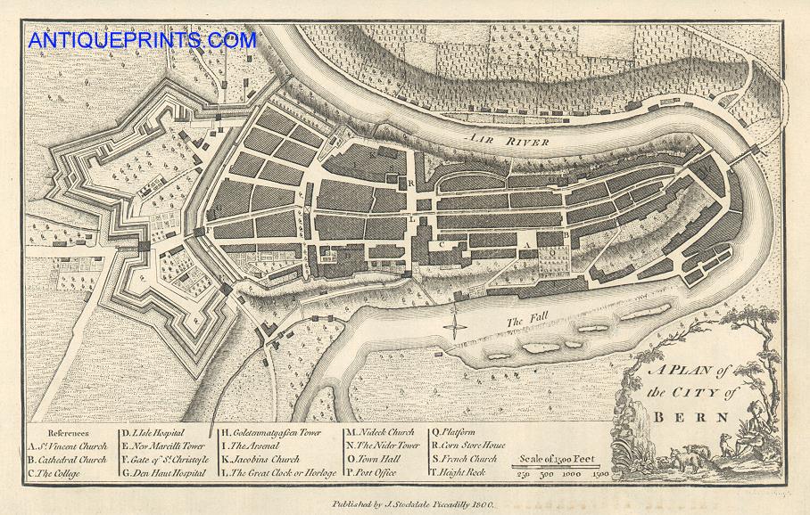
 Switzerland "A Plan of the City of Bern" copper engraved city plan by John Andrews, first published in Plans of the Principal Cities in the World, about 1776. This example was published by by John Stockdale in 1800. The original
measures about 25.5 x 16.5 cms. Click
here for detail showing part
of the map at full resolution (500 dpi). Click the small image
to the left for a larger low resolution version. (Ref sm0260). Digital
image size 16.1 mb at 500 dpi. Switzerland "A Plan of the City of Bern" copper engraved city plan by John Andrews, first published in Plans of the Principal Cities in the World, about 1776. This example was published by by John Stockdale in 1800. The original
measures about 25.5 x 16.5 cms. Click
here for detail showing part
of the map at full resolution (500 dpi). Click the small image
to the left for a larger low resolution version. (Ref sm0260). Digital
image size 16.1 mb at 500 dpi.
Price 5
USD, Click here to buy
_tn.jpg) Austria "A Plan of the City of Vienna" detailed copper engraved city plan by John Andrews, first published in Plans of the Principal Cities in the World, about 1776. This example was published by by John Stockdale in 1800. The original
measures about 25 x 17.5 cms. Click
here for detail showing part
of the map at full resolution (500 dpi). Click the small image
to the left for a larger low resolution version. (Ref sm0086). Digital
image size 16 mb at 500 dpi. Austria "A Plan of the City of Vienna" detailed copper engraved city plan by John Andrews, first published in Plans of the Principal Cities in the World, about 1776. This example was published by by John Stockdale in 1800. The original
measures about 25 x 17.5 cms. Click
here for detail showing part
of the map at full resolution (500 dpi). Click the small image
to the left for a larger low resolution version. (Ref sm0086). Digital
image size 16 mb at 500 dpi.
Price 5
USD, Click here to buy
_tn.jpg) Germany "A Plan of the City of Berlin" detailed copper engraved city plan by John Andrews, first published in Plans of the Principal Cities in the World, about 1776. This example was published by by John Stockdale in 1800. The original
measures about 25.5 x 18 cms. Click
here for detail showing part
of the map at full resolution (500 dpi). Click the small image
to the left for a larger low resolution version. (Ref sm0121). Digital
image size 16mb at 500 dpi. Germany "A Plan of the City of Berlin" detailed copper engraved city plan by John Andrews, first published in Plans of the Principal Cities in the World, about 1776. This example was published by by John Stockdale in 1800. The original
measures about 25.5 x 18 cms. Click
here for detail showing part
of the map at full resolution (500 dpi). Click the small image
to the left for a larger low resolution version. (Ref sm0121). Digital
image size 16mb at 500 dpi.
Price 5
USD, Click here to buy
_tn.jpg) Germany "Berlin" engraved
by J.Henshall after a plan by W.B.Clarke, published by the 'Society for the Diffusion of Useful Knowledge',
1844. The original is a steel engraved antique plan with original hand colour
measuring about 37.5 x 29 cms. Click
here for detail showing part
of the map at full resolution (500 dpi). Click the small image
to the left for a larger low resolution version. (Ref sm0033). Digital
image size 30 mb at 500 dpi. Germany "Berlin" engraved
by J.Henshall after a plan by W.B.Clarke, published by the 'Society for the Diffusion of Useful Knowledge',
1844. The original is a steel engraved antique plan with original hand colour
measuring about 37.5 x 29 cms. Click
here for detail showing part
of the map at full resolution (500 dpi). Click the small image
to the left for a larger low resolution version. (Ref sm0033). Digital
image size 30 mb at 500 dpi.
Price 5
USD, Click here to buy
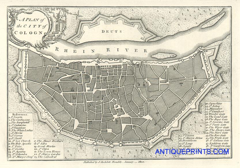
 Germany "A Plan of the City of Cologn" (Cologne) detailed copper engraved city plan by John Andrews, first published in Plans of the Principal Cities in the World, about 1776. This example was published by by John Stockdale in 1800. The original
measures about 25.5 x 18 cms. Click
here for detail showing part
of the map at full resolution (500 dpi). Click the small image
to the left for a larger low resolution version. (Ref sm0220). Digital
image size 14.3mb at 500 dpi. Germany "A Plan of the City of Cologn" (Cologne) detailed copper engraved city plan by John Andrews, first published in Plans of the Principal Cities in the World, about 1776. This example was published by by John Stockdale in 1800. The original
measures about 25.5 x 18 cms. Click
here for detail showing part
of the map at full resolution (500 dpi). Click the small image
to the left for a larger low resolution version. (Ref sm0220). Digital
image size 14.3mb at 500 dpi.
Price 5
USD, Click here to buy
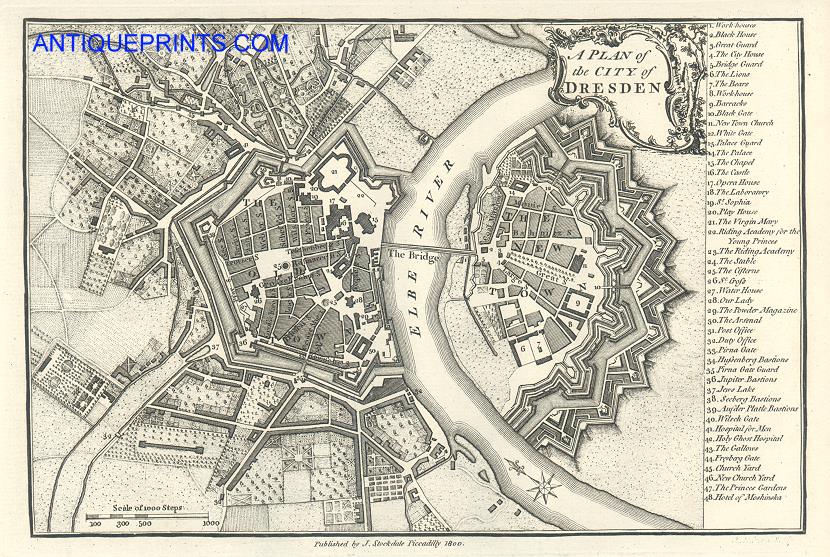
 Germany "A Plan of the City of Dresden" detailed copper engraved city plan by John Andrews, first published in Plans of the Principal Cities in the World, about 1776. This example was published by by John Stockdale in 1800. The original
measures about 25.5 x 18 cms. Click
here for detail showing part
of the map at full resolution (500 dpi). Click the small image
to the left for a larger low resolution version. (Ref sm0221). Digital
image size 18.2mb at 500 dpi. Germany "A Plan of the City of Dresden" detailed copper engraved city plan by John Andrews, first published in Plans of the Principal Cities in the World, about 1776. This example was published by by John Stockdale in 1800. The original
measures about 25.5 x 18 cms. Click
here for detail showing part
of the map at full resolution (500 dpi). Click the small image
to the left for a larger low resolution version. (Ref sm0221). Digital
image size 18.2mb at 500 dpi.
Price 5
USD, Click here to buy
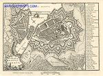
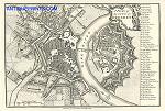
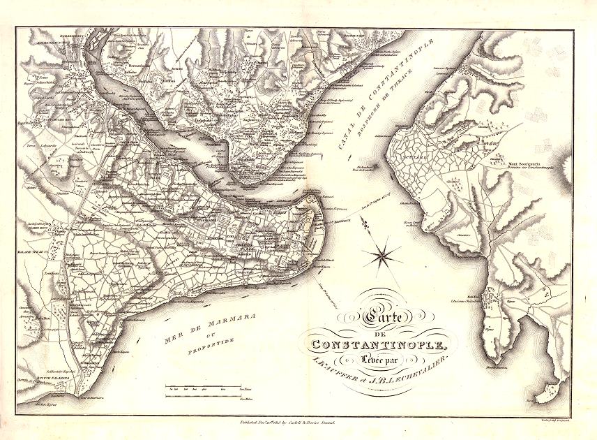
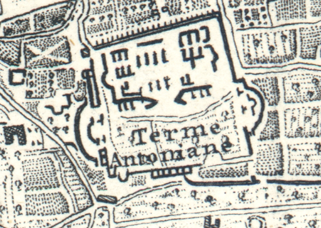
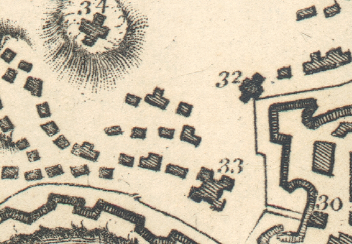
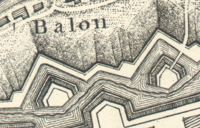
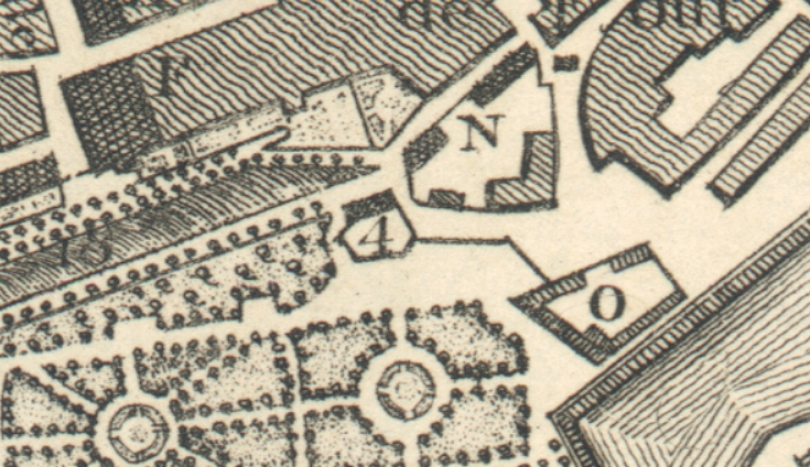
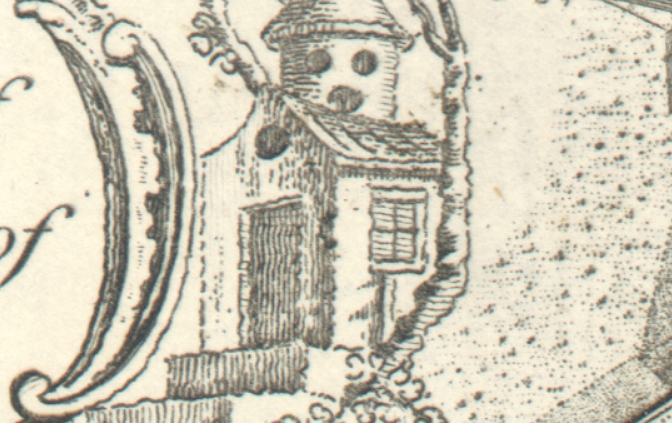
 Turkey "Carte de Constantinople, Levee par I.Kauffer et J.B.Lechevalier" (Istanbul plan) published
by Cadell & Davies, the Strand, 1815 (originally published in France about 1786). The original is a very detailed large copper engraved plan. There is some discolouration to the white areas, but it is an interesting and detailed plan. Click
here for detail showing part
of the map at full resolution (500 dpi). Click the small image
to the left for a larger low resolution version. (Ref sm0182). A very large file, digital
image size 34.4 mb at 500 dpi. Turkey "Carte de Constantinople, Levee par I.Kauffer et J.B.Lechevalier" (Istanbul plan) published
by Cadell & Davies, the Strand, 1815 (originally published in France about 1786). The original is a very detailed large copper engraved plan. There is some discolouration to the white areas, but it is an interesting and detailed plan. Click
here for detail showing part
of the map at full resolution (500 dpi). Click the small image
to the left for a larger low resolution version. (Ref sm0182). A very large file, digital
image size 34.4 mb at 500 dpi.
Price 5
USD, Click here to buy
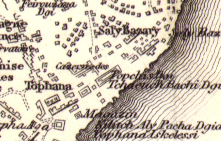
_tn.jpg) Turkey "
Constantinople and the Bosphorus " drawn
and engraved by Alexander Findlay, published
in L'Empire Ottoman Illustre ...,
about 1838. The original is a steel engraved plan
measuring 18.5 x 25 cms. Click
here for detail showing part
of the map at full resolution (500 dpi). Click the small image
to the left for a larger low resolution version. (Ref sm0030). Digital
image size 11.5 mb at 500 dpi. Turkey "
Constantinople and the Bosphorus " drawn
and engraved by Alexander Findlay, published
in L'Empire Ottoman Illustre ...,
about 1838. The original is a steel engraved plan
measuring 18.5 x 25 cms. Click
here for detail showing part
of the map at full resolution (500 dpi). Click the small image
to the left for a larger low resolution version. (Ref sm0030). Digital
image size 11.5 mb at 500 dpi.
Price 5
USD, Click here to buy
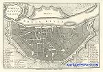
_tn.jpg) "Plan de Goa " (Plan of Goa) by Jacqes Nicolas Bellin, originally published in Paris, about 1750. The original is a copper engraved plan
with recent hand colouring and has two flattened vertical folds. The size of the original is 35 x 21.5 cms including title, plus margins. Click
here for detail showing part
of the map at full resolution (500 dpi). Click the small image
to the left for a larger low resolution version. (Ref sm0091). Digital
image size 25 mb at 500 dpi. "Plan de Goa " (Plan of Goa) by Jacqes Nicolas Bellin, originally published in Paris, about 1750. The original is a copper engraved plan
with recent hand colouring and has two flattened vertical folds. The size of the original is 35 x 21.5 cms including title, plus margins. Click
here for detail showing part
of the map at full resolution (500 dpi). Click the small image
to the left for a larger low resolution version. (Ref sm0091). Digital
image size 25 mb at 500 dpi.
Price 5
USD, Click here to buy
|
|

.jpg)
-l.jpg)
-l.jpg)
-l.jpg)
-l.jpg)
-l.jpg)
.jpg)

.jpg)
-l.jpg)
-l.jpg)
.jpg)
.jpg)
.jpg)
-500-d.jpg)
-d.jpg)
-d.jpg)
-d.jpg)
-d.jpg)
-d.jpg)
-d.jpg)
-d.jpg)
-d.jpg)
-d.jpg)
-d.jpg)
-d.jpg)
-d.jpg)